Drone Stand Counts- Future or Science Fiction?
Self-driving cars, teleportation, a colony on Mars—there are endless ideas for future technologies that would make our lives easier. Some are closer to reality than others.
At Peterson Farms Seed, we have a commitment to exploring new technologies and finding ways to bring more value to farmers– to help you raise more bushels. One of the elusive technologies we’ve been hearing about for years is doing drone stand counts.
There have been several roadblocks to making this happen but the technology seems to be catching up with the idea. And some recent tests have me pretty excited about the potential.
Traditional Stand Counts
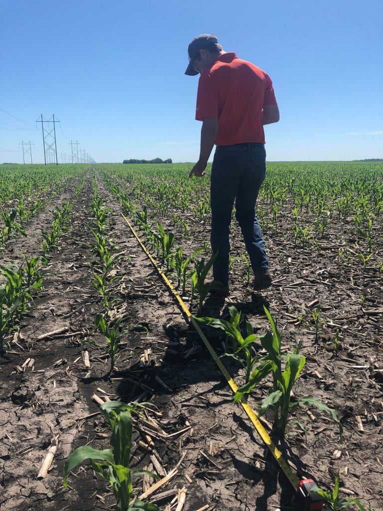
When traditionally doing stand counts, you really can’t cover the entire field, so you take 15-20 counts to represent the variation in the field. Doing 20 stand counts on a 160-acre field only represents 0.0125% of that field. So, the notion of a drone doing the counting sounds pretty great, right?
The Roadblock: Time
Time has been the biggest barrier to being able to use a drone to count a whole field. In order to fly a 160-acre field at 50 feet of elevation with enough overlap to map the entire field would require 44 batteries, with 21,415 pictures, and take 11.5 hours!
To solve for this, some tech companies have started to marry traditional stand evaluation techniques with the technology. The idea is to lower the overlap so that the drone is only taking a single picture every acre and analyzing that single picture to determine the total stand of that spot.
With this approach you’d cut back on the time and total pictures taken BUT would gather a lot more information when compared to boots on the ground scouting:
160 acre field= 160 pictures, each with 50 stand counts totaling 8,000 stand counts/field
Testing the Tech
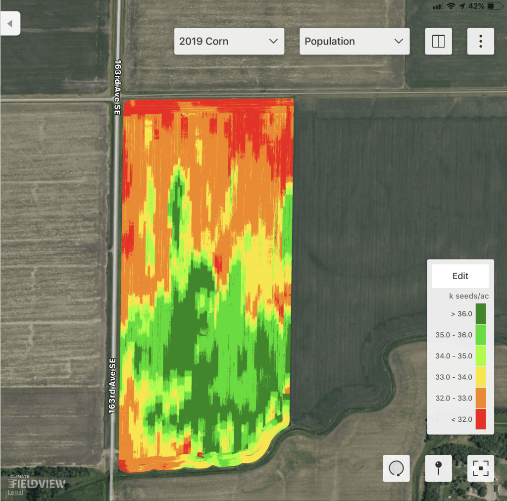
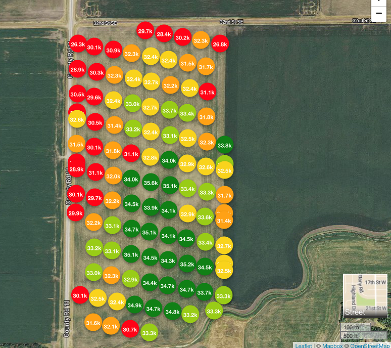
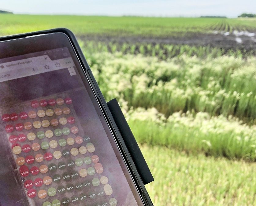
To test this technology, we flew and analyzed a field weekly. In the picture below you can see that we variable rate planted this field. We chose this field to see if the stand counting technology would pick up the change in population.
The below photo shows that it did exactly that! It also shows a close correlation to the planting map. We then went out and verified the drone captured number with traditional stand counts and determined the numbers to be reasonably accurate. Some were even more accurate than hand counting.
Bottom line, this technology looks promising! We will keep testing and reporting back on our findings. Look for future posts about the work we are doing with new technology and precision ag. Call or email me if you have questions about how to implement precision ag practices on your farm. Nolan@PetersonFarmsSeed.com or (701) 282-7476.

