Tap Into These Weather Resources Every Day for a Top Crop
As the resident weather guy I’m often asked which weather sources I trust. There are a lot of options out there, some better than others. The truth is the best information comes from a variety of sources, with NO HYPE!
6 weather resources farmers should check daily:
- NOAA 7 –Day Local Forecast
- Wunderground Local Radar
- NOAA 8 – 14 Day Forecast
- Useful 2 Useable- Custom GDU’s
- NOAA Facebook Pages
- National Weather Service Custom Precipitation Totals
#1: NOAA Local & Hourly Weather Forecast
Where to find it: https://forecast.weather.gov/MapClick.php?lat=46.285402300000044&lon=-95.87310489999999#.YJBBxbVKhPa
Frequency: I check it first thing in the morning and three times during the day.
Best way to access: Online with phone, iPad or computer
Key uses and features:
Local Forecast: Create shortcuts on your phone’s home screen or desktop to make quick work of checking the 7-day outlook. This is by far the most accurate resource out there.
Hourly Outlook: For a detailed hour-by-hour view, check out the “Hourly Weather Forecast” view. I literally plan my life around this. Everything from road conditions in the future to which deer stand to sit in based on wind. Hourly Forecast
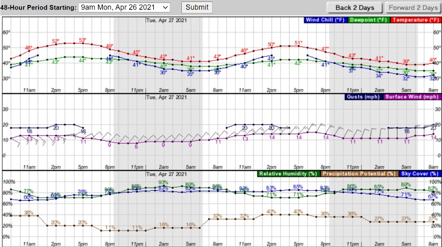
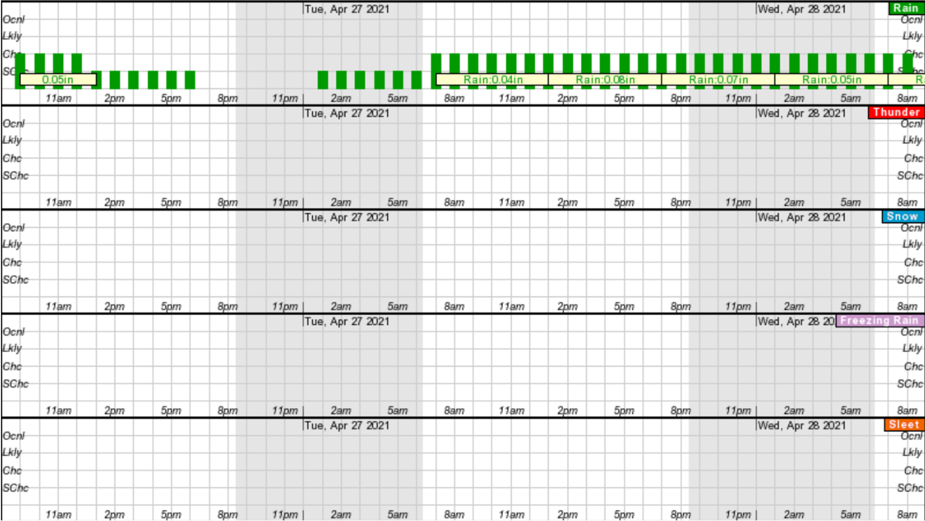
In this example you can see the forecast for the 27th was 50 degrees with a NE wind gusting to 20 mph and 85% cloud cover. In the precipitation graph you can see a slow drizzle all day from 8am Tuesday to 8am Wednesday, accumulating .25”. And this is almost always spot on!
Three-Day History: This is a nice tool to look back. When did a gust front hit? What were the peak wind speeds and from which direction did it blow? How much rain did you get? This view will help you answer those important questions.
#2: Wunderground
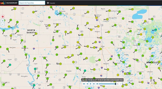
Where to find it: https://www.wunderground.com/wundermap?lat=46.88&lon=-96.8&zoom=8&radar=1&wxstn=0
Frequency: I use this daily when there are weather events I want to keep an eye on.
Best way to access: Online or by downloading their App
Key uses and features:
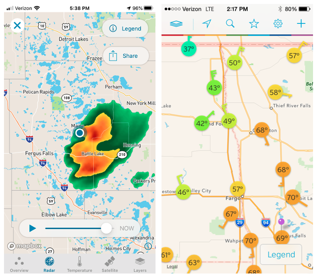
- This is a great source for accurate radar.
- I like that you can zoom in as close as a few miles during a rainstorm with nice accuracy.
- It also has a great collection of private weather stations to view. There are 6 weather stations to look at within 10 miles of my house!

#3- 8-14 Day NOAA Weather Forecast
Where to find it: https://www.cpc.ncep.noaa.gov/products/predictions/814day/
Frequency: I use this daily, especially leading into planting season and harvest.
Best way to access: Online using phone, iPad or computer
Key uses and features:
- I typically use 8-14 day tool when planning spring planting.
- Forecast shows trends for an extended range.
- Not as accurate as a 7-day forecast, but will get you within 10 degrees of average for temp and predict if rain is on the way.
- I consider this a “ballpark” tool.
A few words of caution:
- This outlook can change a lot so don’t take it as gospel.
- Make sure you check daily to stay on top of changes.
#4- Useful 2 Useable: GDU tracker
Where to find it: https://mrcc.purdue.edu/U2U/gdd/
Frequency: Weekly during the summer.
Best way to access: Online using phone, iPad or computer
Key uses and features:
- A great summertime tool.
- Click on your location to calculate accurate GDU’s based on your location, planting date and even hybrid if you know how many GDU’s needed to get to black layer.
- A great way to roughly see when the crop will mature.
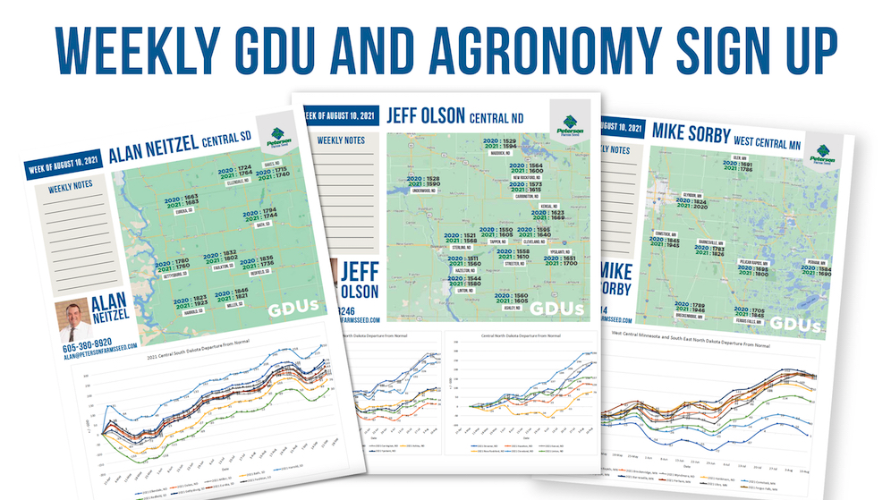
Shameless plug: I actually do this work for you! Subscribe to my weekly email update and receive a GDU report (see this week’s report here!) for locations across our footprint throughout the growing season.
#5- NOAA Facebook Page Maps
Where to find it: see links below
Frequency: Daily throughout the year
Best way to access: Online using phone, iPad or computer
Key uses and features:
- NOAA Station Facebook pages have the best graphics to visualize what kind of weather is coming in the next couple days.
- I follow stations from Florida to Alaska.
- These maps give a visual summary of timing of rain, amounts and temperature better than anywhere else I know of.
- I recommend following at least one or more local stations plus a couple west of you to see what weather might be showing up in your area in a few days.
- Example: if eastern Montana gets hammered with 60mph winds there is a good chance Fargo will get a 40mph wind the next day. Monitoring stations west helps visualize what our weather might do in subsequent days.
Quick links to stations in and around our footprint:
#6- National Weather Service Custom Precipitation Totals
Where to find it: https://preview.weather.gov/edd/
Frequency: After precipitation events
Best way to access: Online using phone, iPad or computer
Key uses and features:
- Use when you want to look back at how much precipitation we received from a storm.
- This site is also the most customizable of any I’ve ever seen with over 100 different layers that can be added.
- Toward the bottom in the “Layer Tree” you will find observations. In there the most common one I use is “24 Hour Precipitation CONUS”.
- Run a 72–hour view if there’s been a multi-day event.
Everything we do in agriculture revolves around the weather! Having the BEST tools at our fingertips to make sound management decisions is critical to maximizing yield.
These are just a few of the many sources I use regularly. If you have questions or want to know what I’m seeing in your area, just give me a shout. I’d love to be a resource for you. And be sure to sign-up to receive my weekly GDU Snapshot emails!

