What Are UAVs Looking At?

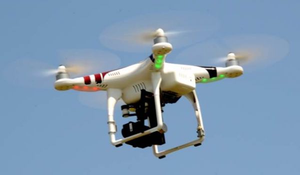
What are UAVs really doing when flying or hovering over a field? While working with UAVs (Unmanned Aerial Vehicles), I’ve had many questions from growers about what they can really do.
To understand the possibilities for UAVs, we must first understand the term “NDVI”. What does NDVI mean, and how does it relate to the real purpose of UAVs? To understand NDVI (Normalized Difference Vegetative Index), we first have to understand how plants reflect light.
NDVI Explained
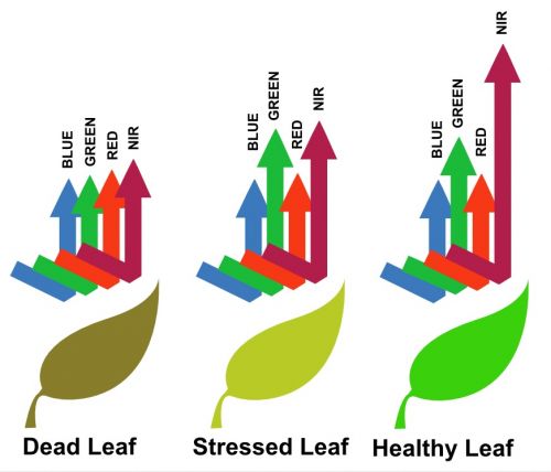
Plants such as corn and soybeans are green because their leaves and tissue reflect the color green while absorbing all other colors in the visible light spectrum (like red and blue). The plants use the light energy they absorb to convert into carbohydrates. Plants also reflect near infrared (NIR) light, a light source that is not within our visible light spectrum. The amount of NIR light that is reflected is substantially more than that of the green light (shown in Figure 1).
As plants begin to stress, they stop absorbing red and blue light to use for energy. Instead, stressed plants begin to reflect all colors in the visible light spectrum, which gives the plants a yellow or brown color.
This is important because stressed plants reflect considerably less NIR light, compared to healthy plants. Since we cannot see NIR light, if we can use sensors to measure the large drop of NIR reflectance due to a stressed plant, we can potentially detect a stressed plant before the stress is visible to our eyes. And that is the potential for UAVs! Imagine the day when you will know your plants are stressed before you can see it!
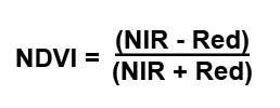
The components in the NDVI equation are shown here:
Notice that there is a – sign on top of the equation and a + sign on the bottom. This ensures that no matter the inputs for NIR or Red, the result will always be a number between -1 and 1, creating an index. Healthy green tissue will be closer to 1, with bare soil and water resulting in a number around zero or lower. This gives us definitive numbers for areas of the field, and these numbers can be used to determine zones of interest.
Goals
Creating zones is the ultimate goal of using NDVI maps from UAVs. If the UAV detects crop stress before the human eye can, and can actively do something to reverse that stress, we will be on track to increase our yields and efficiency. For example, we could fly a field and develop an NDVI map to show areas of the field that are nitrogen deficient. We could then create a variable rate side-dressing map to target those low nitrogen areas.
Roadblocks
As with any new technology, there are a few issues to work through–specifically light quality during flights. Spotty clouds will skew light reflectance in areas of shade during the flight. Also, light will differ between flights that occur at different times of the day. For this reason, it is difficult to compare the NDVI values for multiple flights, but we can still compare values within one flight. For example, this past summer I was flying a field when cloud cover rolled in halfway through the flight. Once the final image was processed, one side of the field appeared much brighter than the other side. This could give the impression that something is stressing the plants on half of the field, if one did not know about the cloud cover.
Future
The UAV industry will push technology very quickly in the next few years, and we will see refinements in the NDVI process. The industry will use a variety of sensors–multispectral, thermal, and elevation sensors. As sensors become more accurate, we will also be able to detect many other stresses including weeds, insects, diseases, and drift.
So the next time you see a UAV flying above a field or the topic comes up while having coffee with friends, you’ll be able to impress and inform them by explaining NDVI and how it works!


